Representation & Plantation
26 February 2014 5:00 pm at SAUL Studio
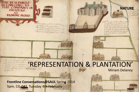
Speaker: Miriam Delaney
The Plantations of the early 17th century resulted in radical changes to the landscape of Ulster. The Londonderry plantations were mapped by the cartographer Thomas Raven in 1620 and document the fourteen villages and two towns constructed and settled by twelve London Guilds, and their hinterlands. A close reading of the maps reveals much about the urban morphology of these plantations settlements, the social and demographic structure of the villages (native, settlers and freeholders) and the architecture and typologies evident. They also unintentionally expose the colonial mind-set that accompanied the plantations of Ulster.
Miriam Delaney is an architect and lecturer, who has taught in UCD, QUB and is currently first year architecture year head in DIT.